


- おすすめ
英文登山地図
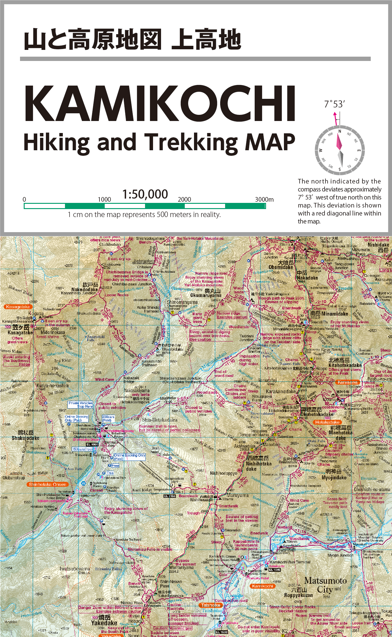
KAMIKOCHI
KAMIKOCHI
Release date: July 17, 2025
この商品は『山と高原地図 槍ヶ岳・穂高岳 上高地』の英語表記地図です。
日本語表記版はこちらの商品をご購入下さい。
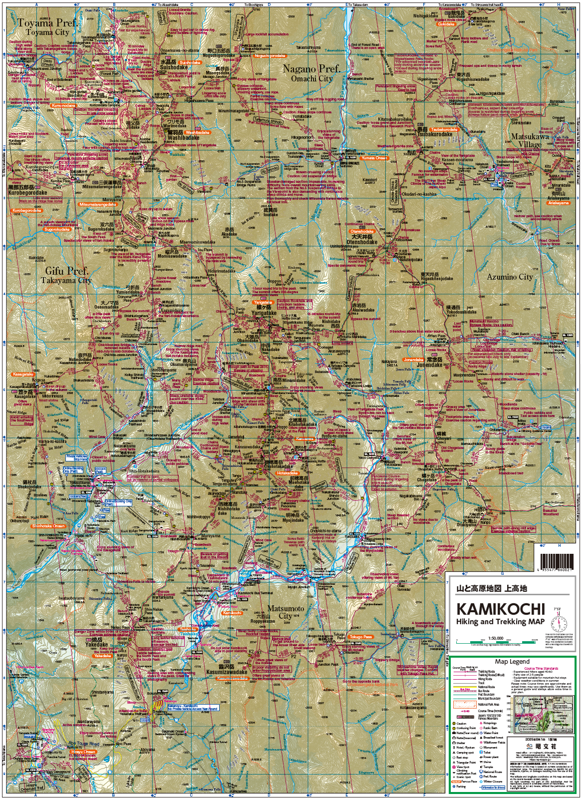
「KAMIKOCHI Hiking and Trekking Map」 produced by one of Japan’s leading map publishers.
This product is the English-language edition of the "Yama to Kougen Chizu" hiking map for the Mt. Yari, Mt. Hotaka, and Kamikochi area.
※Please note that we only ship to addresses within Japan.
受取状況を読み込めませんでした
- 判型 ー
- ページ数 ー
- 寸法(mm) 160x250x2
- 発売日 2025/07/17
- ISBN-10 4398860029
- ISBN-13 9784398860026
 ピンチでズームイン&アウト
KAMIKOCHI
KAMIKOCHI Area Hiking and Trekking Map

The Hiker's Essential Companion
With a 60-year legacy, this is the definitive map for hiking and mountaineering in Japan. An indispensable tool for tracking your destination and current location.
60-Year Bestseller: A trusted brand for generations of hikers.
Up-to-Date Info: Annually updated with on-site surveys by professionals.
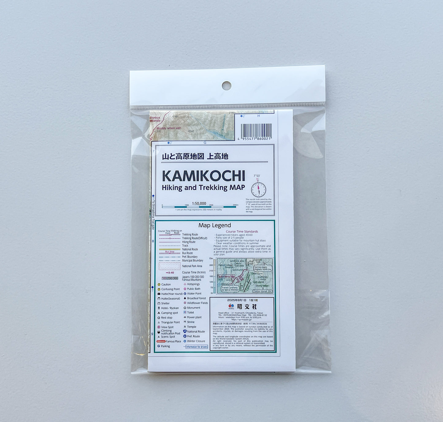
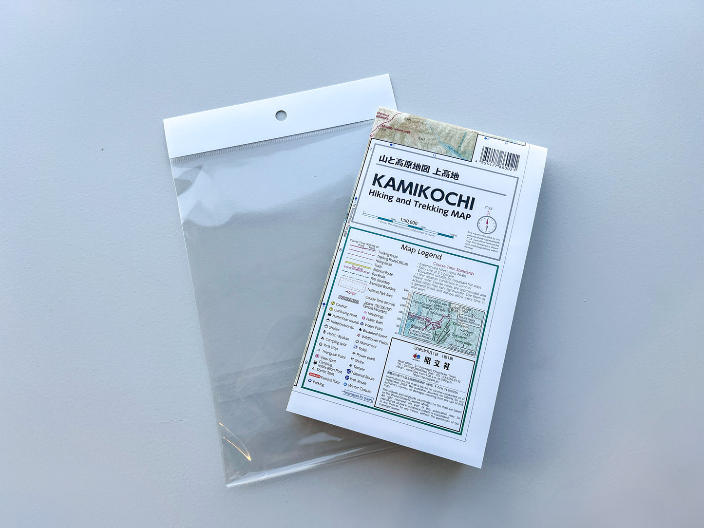
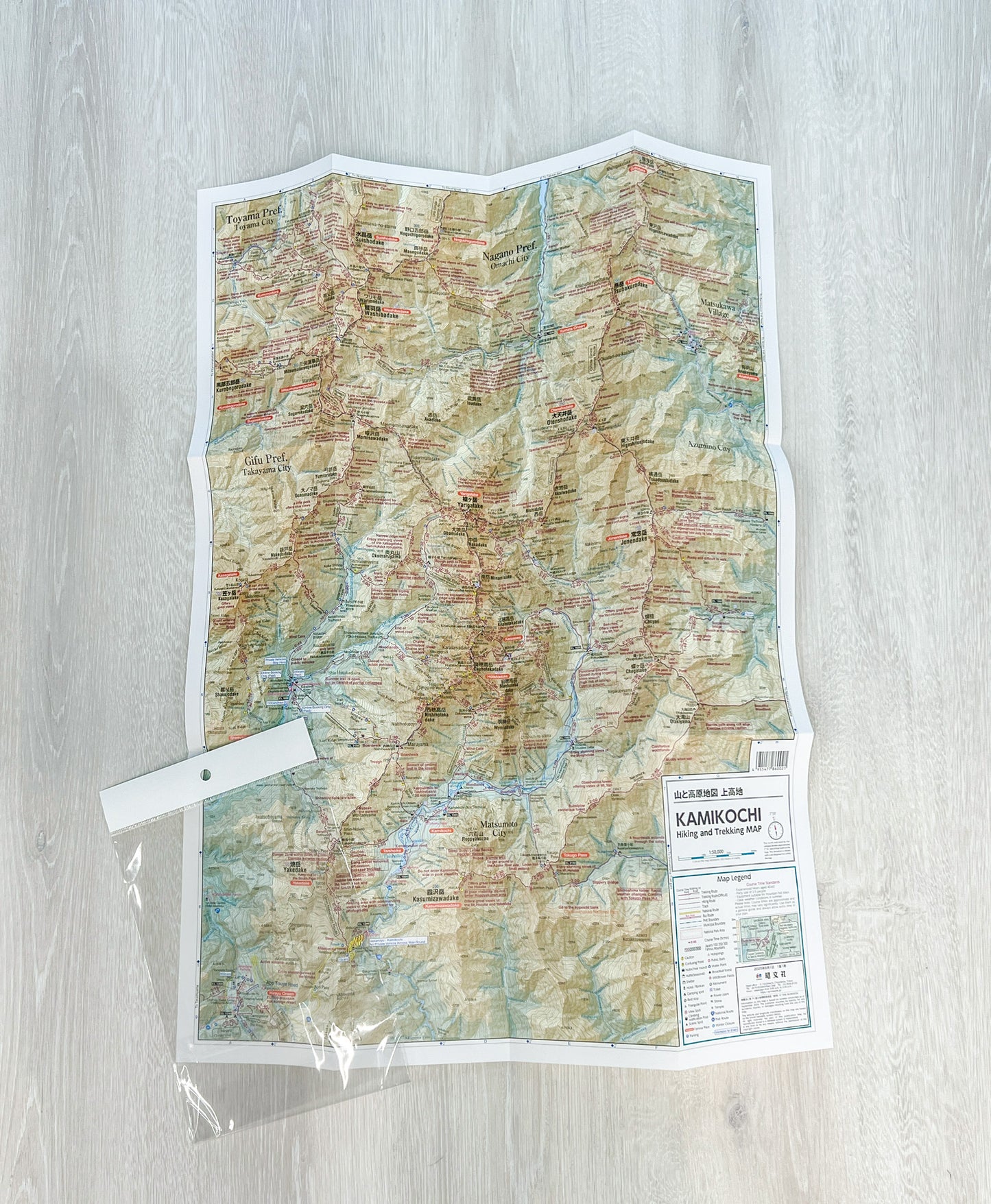
Product Details
The Classic Map for Enjoying Mountain Hiking
"Yama to Kogen Chizu" (Mountain and Highland Map) is a long-selling mountaineering map brand with a 60-year history. It covers all of the "100 Famous Japanese Mountains" selected by Kyuya Fukada and encompasses major mountainous areas. The information is kept up-to-date with annual on-site surveys by mountain professionals. It's an essential item that helps you grasp your "destination" and "current location," which are crucial when hiking.
Crafted for Practicality with On-Site Surveys
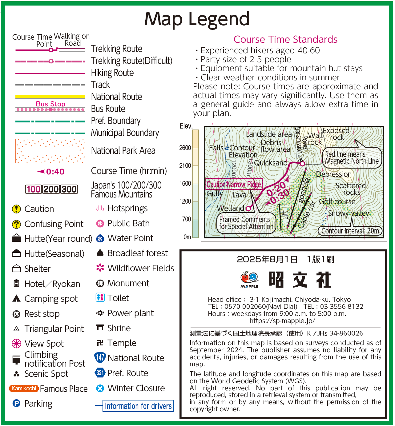
This map is meticulously designed with a focus on "practicality" for both planning and actual mountaineering. Essential information, including hiking trails, locations of mountain huts and water sources, hazardous spots, and landmarks, is verified through on-site surveys. Junctions and complex routes are detailed with enlarged maps and illustrations. Points with a high risk of getting lost are clearly marked.
Additionally, magnetic north lines are pre-printed at regular intervals, making it easy to check the declination between true north and the magnetic north indicated by a compass.
Specifications
Main Mountains & Areas Covered
- Mt. Yari & Mt. Hotaka
- Mt. Yake & Mt. Tsubakuro
- Mt. Jonen & Mt. Kasa
- Kamikochi
- Mt. Kasumizawa & Mt. Otensho
Dimensions
- Map Size (unfolded): 469mm x 636mm
- Package Size: 250mm x 160mm x 2mm
地図屋本舗 目利き衆
地図のことを知り尽くしたプロ
「目利き衆」のおすすめで
地図の楽しみ方がもっと広がる!
-

武者 和実
手代
47都道府県、海外74か国を旅する編集者。最近はロケ地、聖地巡礼に精をだす。現地の情報を重視し、独自の鋭い視点で地図や旅行ガイドの企画・編集につなげる。
-

工藤 信広
棟梁
レールウェイマップルの企画立案者にして編集責任者。鉄道をメインとした地図はもとより、社内商品の表紙デザインチーフも担う。
-

大島 淳
棟梁
登山、バイク、列車、車と多趣味な元まっぷる編集長。いわゆる「乗り鉄」として旧国鉄含むJR全路線制覇という偉業も成し遂げる。
-

甘夏 蜜柑
職人
未来の地図好きを育成するべく子供向け商品の企画編集者。列車や歴史、地理など地図にかかわる企画を子供にわかりやすく伝えます。
-

市川 智教
番頭
近隣の学校に出向いて地図製作授業の講師を行ったり、関連業界の会合に出席するなど、地図業界の発展に勤しむ。


